Courtesy photo.
SANTA BARBARA — On Wednesday, March 14, community leaders throughout the county unveiled the Santa Barbara County Conservation Blueprint (Blueprint). The Blueprint report and the companion online Atlas mapping tool are the result of nearly two years of design, research, data collection, interviews, focus groups, and public input meetings by over 200 community members. The purpose of the Blueprint is to provide a common language and platform for publicly available data to support informed decisions about conservation and planning for the future of Santa Barbara County. Project organizers also see a broad range of uses for this powerful tool including to support agriculture, housing and urban development, increased access to nature and education about the region.
“As our communities across Santa Barbara County experience extended droughts, increased fires and debris flows, we need to gain a greater understanding of the relationship between nature, humans and the unique landscapes we call home,” said Ron Gallo, President/CEO of the Santa Barbara Foundation. “The Conservation Blueprint is an example of how gathering data and convening people to have challenging conversations can produce a meaningful community tool that will lead toward a more resilient Santa Barbara County.”
The project is a collaboration between The Land Trust for Santa Barbara County, Cachuma Resource Conservation District, and the Santa Barbara Foundation LEAF (Landscapes, Ecosystems, Agriculture, and Food Systems) Initiative. The team joined forces with a 13-member steering committee to guide the process.
“The Blueprint is the first impartial, complete, up-to-date source of data that has been fully vetted and verified and made available to everyone, not just a single interest group,” said Pamela Doiron, a rancher from The Spanish Ranch in Cuyama Valley and a member of the Blueprint Steering Committee. “From urban areas to watersheds, public lands, rangelands, and agriculture, the Blueprint describes, in easy to understand terms, the resources of Santa Barbara County — fully descriptive and not prescriptive. It is my hope that when future decisions are made that affect all of us in Santa Barbara County, we will make sound, informed evaluations based on this common information.”
The extensive report focuses on major land conservation themes – water, flora and fauna, agriculture and ranchlands, and community and the land. Climate change impacts to these theme areas are featured throughout the report, along with community values and stories of multi-benefit solutions and resilience in the face of resource challenges and scarcity. The online Atlas houses nearly 300 science-based datasets that can be viewed as maps, analyzed, and shared to spread an understanding of land use and natural resources in the county.
“The Blueprint is a remarkable collection of information that will be valuable to this community for generations. It represents a first step toward a common understanding of the condition of Santa Barbara County’s land and will inform future conversations about how we continue to grow our community and preserve our heritage and conserve the resources around us,” said Chet Work, Executive Director of The Land Trust for Santa Barbara County and project partner.
The Blueprint is a community conceived and driven plan, and government agencies were not involved in the development of the project.
“It was important to ensure the voice of the farming and ranching community in the Blueprint,” said Anna Olsen, Executive Director of the Cachuma Resource Conservation District and project partner. “What is particularly significant about the Blueprint is that it levels the playing field and provides the same valuable information to everyone in the community, and that it’s not trying to create new policy or new regulations. It provides a common language for us to promote our own interests and passions, explain these passions to others, and work together to understand each other.”
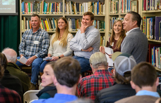
The Santa Barbara County Conservation Blueprint was released on March 14 at two events: the first at the Santa Barbara Botanic Garden and the second at the Santa Barbara Foundation offices in Santa Maria. Those who spoke about the project and how the Atlas tool can be used included Santa Barbara Foundation President/CEO Ron Gallo and Senior Director of Community Investments and LEAF Initiative Director Sharyn Main, The Land Trust for Santa Barbara County Executive Director Chet Work, Cachuma Resource Conservation District Executive Director Anna Olsen, and steering committee members Steve Windhager (SB Botanic Garden), Paul Van Leer (Las Varas Ranch), Randy Sharer (Sharer Brothers Farms) and Pamela Doiron (Spanish Ranch).
“It is our hope that the Blueprint will inspire greater collaboration and is just as beneficial to farmers and ranchers, housing advocates and developers as it will be to conservation,” said Sharyn Main, Senior Director of Community Investment and Director of the Santa Barbara Foundation LEAF Initiative. “The information in the report and the data from the Atlas maps will be used to support decisions that benefit our community as a whole. The Santa Barbara County community has spoken, and the Blueprint report captures those stories as they relate to some of the most critical components of the long-term health of our local landscape.”
Visit www.sbcblueprint.net to learn more about the Blueprint project, view and download the complete Blueprint report and the executive summary, and explore the online Atlas. If you have questions about the Blueprint, please email the Blueprint planning team at info@sbcblueprint.net
About The Land Trust for Santa Barbara County: Since 1985, The Land Trust has worked with willing landowners, public and private grant agencies and other community organizations to conserve, restore and manage open space, wildlife habitat and agricultural land in Santa Barbara County by:
Acquiring land and conservation easements with willing private property owners, through charitable donation and purchase.
Creating conservation plans, restoration projects and incentives for landowners. Raising private donations and grants from government, foundations and corporations to support land conservation.
Promoting the preservation, stewardship and restoration of wildlife habitat and watershed resources on the land we protect.
Educating both children and adults about ecology, agriculture and conservation through programs and events at Land Trust preserves. To date, The Land Trust has protected nearly 27,000 acres of land and has completed or is underway on close to twenty habitat restoration, open space and trail projects.
About the Cachuma Resource Conservation District: The mission of the Cachuma Resource Conservation District (CRCD) is to promote land stewardship ethics that result in long-term, sustained use of natural resources while protecting and enhancing the environment. Founding principles include total resource management, effective technical services, diverse community partnerships, and strong grower relationships.
About the Santa Barbara Foundation LEAF (Landscapes, Ecosystems, Agriculture and Food Systems) Initiative
The Santa Barbara Foundation is committed to preserving the natural beauty, ecological integrity and productivity of the wild and working lands in Santa Barbara County for generations to come. To that end, the foundation has launched the LEAF Initiative with the goal of strengthening community resiliency by preserving and enhancing the landscapes and systems that sustain nature, human health and our economy.
The LEAF Initiative was developed through a collaborative effort with community members, nonprofit organizations and donors. The initiative seeks to advance regional strategies to increase land conservation, improve ecosystem health, ensure agricultural viability and improve the local food system. Together with community partners, we are supporting the development of science-based tools and approaches for lasting conservation and system improvements in Santa Barbara County.